Accumulation Radar is a radar system operated by the Center for Remote Sensing and Integrated Systems (CReSIS) at the University of Kansas. It provides high-resolution profiles of the top 100 meters of the ice column to map variations in snow accumulation rates. For airborne operations, it operates in the 600-900 MHz range and has a 28 cm depth resolution in ice. For ground-based observations, it operates across the 500 MHz to 2 GHz frequency range and has a 5.6 cm depth resolution.

Instrument Details
- Radar
- Earth Science > Spectral/engineering > Radar > Radar ImageryEarth Science > Climate Indicators > Cryospheric Indicators > Snow CoverEarth Science > Cryosphere > Glaciers/ice Sheets > Glacier Topography/ice Sheet TopographyEarth Science > Climate Indicators > Cryospheric Indicators > Sea Ice Elevation
- Full Column Profile, Land Surface
- Variable
- 28 cm
- 600-900 MHz
- Currently unavailable
Prasan Gogineni, Carl Leuschen
Prasan Gogineni, Carl Leuschen
Currently unavailable
Currently unavailable
Currently unavailable
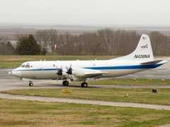
 P-3 Orion 30 Campaigns · 153 Instruments |  Operation IceBridge 2009—2021 Greenland, Antarctica, Alaska, Arctic Sea 37 Deployments · 79 Data Products
|
Filter data products from this instrument by specific campaigns, platforms, or formats.
CAMPAIGNS
PLATFORMS
FORMATS